
Walk a Deltona Street Directory
A useful Deltona street search separates ownership from occupancy at the start. The Volusia County Property Appraiser, or VCPA, identifies the tax parcel, named owner, site address, tax-mailing address, and property class. A deed can then confirm a recorded transfer. A permitted voter extract or an old reverse directory may identify people tied to the address, but neither supplies a complete household. Work from the address outward and keep the parcel identifiers with every note.
- Enter the house number and street in the VCPA Classic Real Property Search. Start broad by leaving the direction, suffix, unit, city, and ZIP blank if the first attempt fails.
- Open the parcel card and copy the alternate key, short parcel ID, owner spelling, site address, mailing address, subdivision, block, lot, and legal description.
- Use the VCPA search and map hub to click adjoining parcels. Review all hits on the named street because corner lots and vacant parcels can break the number sequence.
- Carry the parcel and owner name into the Volusia Official Records Inquiry. A recorded deed provides stronger ownership evidence than the assessment roll alone.
- For a lawful street-level resident view, request the allowed Elections extract. For older occupants, check reverse directories and newspapers through the county library.
The flow is address to parcel, parcel to owner, owner to deed, then address to resident evidence. That order cuts down same-name errors and makes the Deltona street directory reproducible.
Search Deltona Streets in VCPA
VCPA Classic is the main address index for a Deltona street directory. Its search form permits a narrow house search or a broad street browse. Owner names use the format last name, then first name, with punctuation left out. An asterisk works as a wildcard, and an ending wildcard is implied. Search results can show the alternate key, short parcel number, owner, site address, city, and class.
| Deltona search field | Best use | Format note |
|---|---|---|
| Street number, direction, name, suffix, unit | One address or every parcel by street | Remove optional parts if no result appears |
| Owner name | Find parcels held by a person or entity | LastName FirstName; wildcard accepted |
| Short Parcel ID or Alternate Key | Return to an exact parcel | Copy directly from the result |
| City and ZIP | Filter broad street-name results | Use after the first broad search |
| Subdivision, block, and lot | Bridge address changes | Match the legal description |
| Section, township, range | Research land-grid descriptions | Useful when street text is weak |
The result tools can select a page or all rows, display selected parcels, and export Excel or mailing-list output. That makes it possible to preserve a whole street slice instead of copying one card at a time.
The Volusia parcel search hub shown here leads to real-property and map modes.
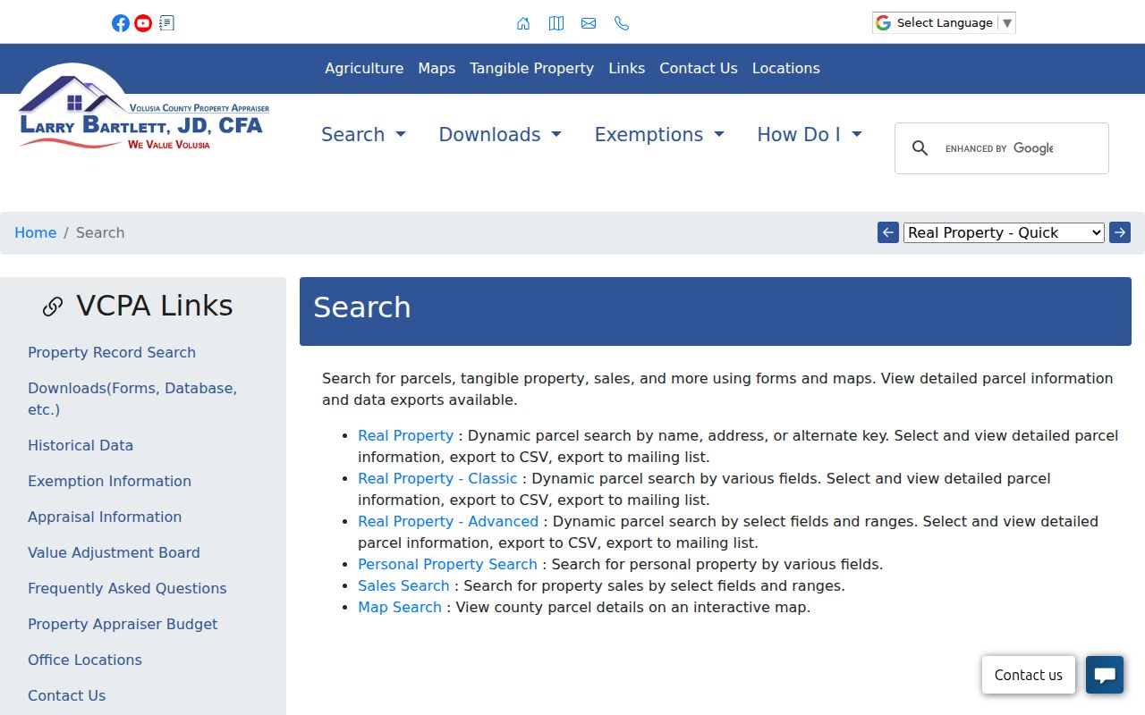
The screen is the official starting point for moving from a typed Deltona address to its tax parcel and map.
Deltona Street and Mailing Addresses
The detailed parcel card keeps two address ideas apart. The situs address is where the land or building sits. The mailing address is where the owner receives tax notices. They may match, but a different mailing address does not prove the owner moved, and a match does not name every person inside the home.
Homestead information can support an owner-occupancy conclusion when combined with the matching addresses. It still cannot identify renters, relatives, guests, or other household members. In the Deltona street directory, label each address as site or mailing rather than placing both in one unlabeled field.
- Parcel
- A mapped tax unit with its own property identifiers; it may be improved, vacant, or part of a larger visual site.
- Situs address
- The physical site address assigned to the parcel.
- Plat
- A recorded map that lays out a subdivision, lots, blocks, streets, and related boundaries.
- Criss-cross directory
- A historical directory arranged by street and house number instead of by surname.
Note: A tax-mailing match supports owner occupancy, but it never proves the full makeup of a Deltona household.
Map Deltona Parcels Along Streets
Deltona's curving subdivision streets do not always behave like a simple number grid. In the VCPA map, parcel lines define ownership units. Zoom to the subject parcel, switch between list and map views, and click nearby polygons. A house that looks next door from the road may not share a legal boundary.
The map can display parcel boundaries, aerial imagery, and county or some city zoning. Its surrounding-owner feature can produce a list for nearby tax parcels. Use that list as an ownership map, not as a roll of residents. The GIS and Deeds contact number is 386-822-5720, while VCPA's Deltona, Orange City, and DeBary residential division is 386-775-5257.
The VCPA maps page documents the map tools used to browse a Deltona street.
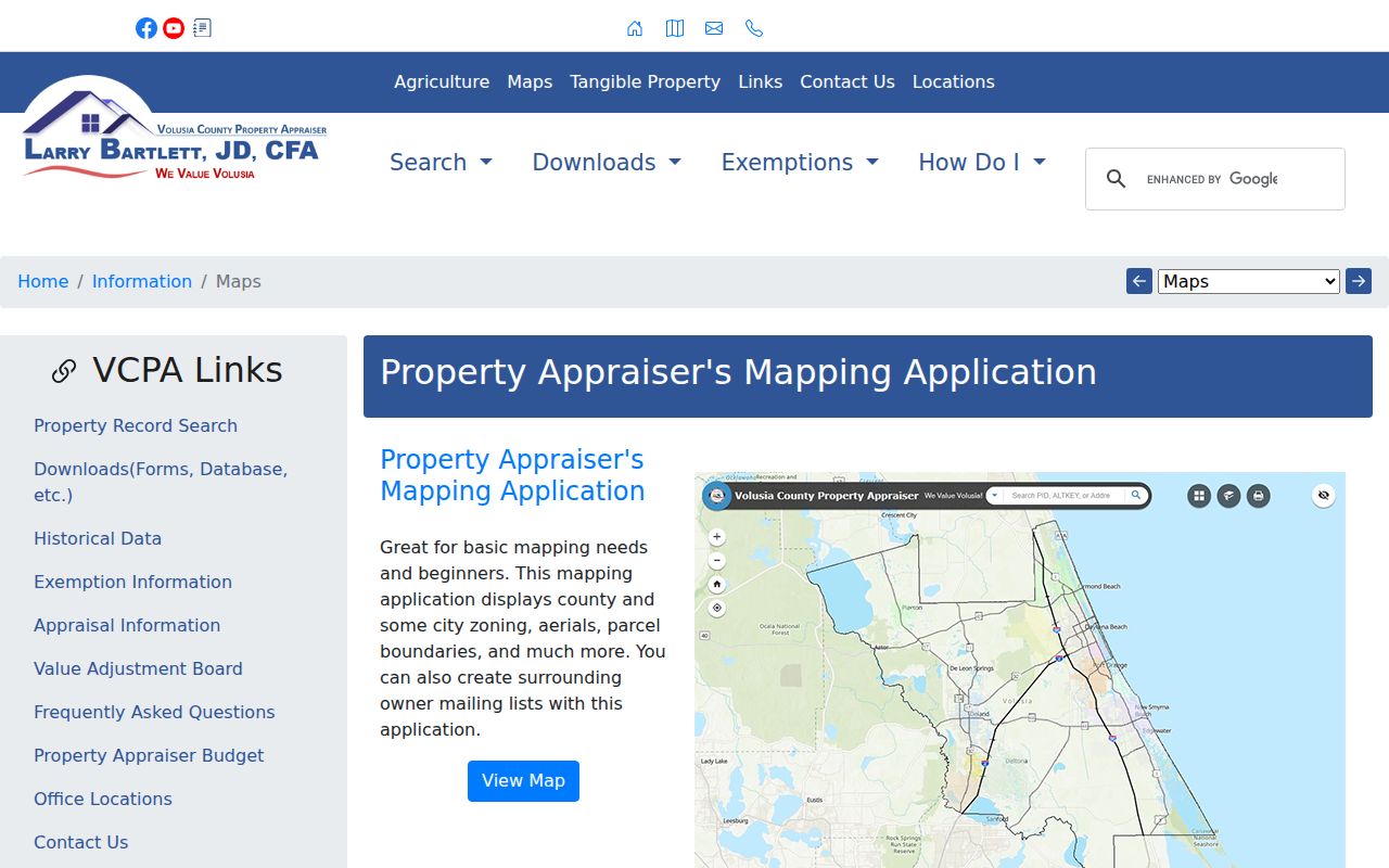
The parcel display helps distinguish a visual block from the recorded parcel pattern beneath it.
Deltona Street Records by Address
A complete by-address search uses every channel documented for the record type. Online tools handle current parcels and newer recorded documents. The Clerk's DeLand research room carries older official records. Elections supplies approved voter files by request, and the City Clerk handles municipal permits or code records when the live portal does not expose the needed search.
| Address source | Official keeper | Street evidence | Access route |
|---|---|---|---|
| Property roll | Volusia County Property Appraiser | Owner, site and mailing address, parcel, class | Free VCPA search and export |
| Parcel map | VCPA GIS | Parcel lines, adjoining owners, aerial and zoning layers | Free map; click and browse |
| Deeds and liens | Volusia County Clerk and Recorder | Indexed parties, transfers, liens, legal description | Online from April 4, 1988; DeLand research room to 1887 |
| Voter extract | Volusia Elections | Permitted registrations sorted by residence or precinct | Written request; protected fields removed |
| Permits and code files | City of Deltona | Address, applicant or contractor, dates and status when present | City portal or Chapter 119 request |
| Reverse directory | Library database or shelf | Historical occupant or subscriber by house number | Branch, licensed database, or reference help; exact years unverified |
The parcel number ties property, deeds, and many municipal files together. The normalized street address connects the parcel to voter and directory evidence. Preserve both keys because either one can fail in an older index.
Turn Deltona Parcels Into Deeds
Start with the current owner's recorded spelling and the most recent transfer shown on the parcel card. In Official Records, search the name, instrument, book and page, date range, document type, case number, or parcel when indexed. The result may display instrument, recording date, book/page, type, name, comments, status, and the party's direction in the transaction.
Open the actual deed and compare the legal description before accepting it. A grantor conveys an interest; a grantee receives it. To step back, search the current grantor as an earlier grantee. Keep the subdivision, lot, and block in view so a same-name record for other land does not enter the chain.
The Volusia Official Records Inquiry pictured below is the web channel for released records.
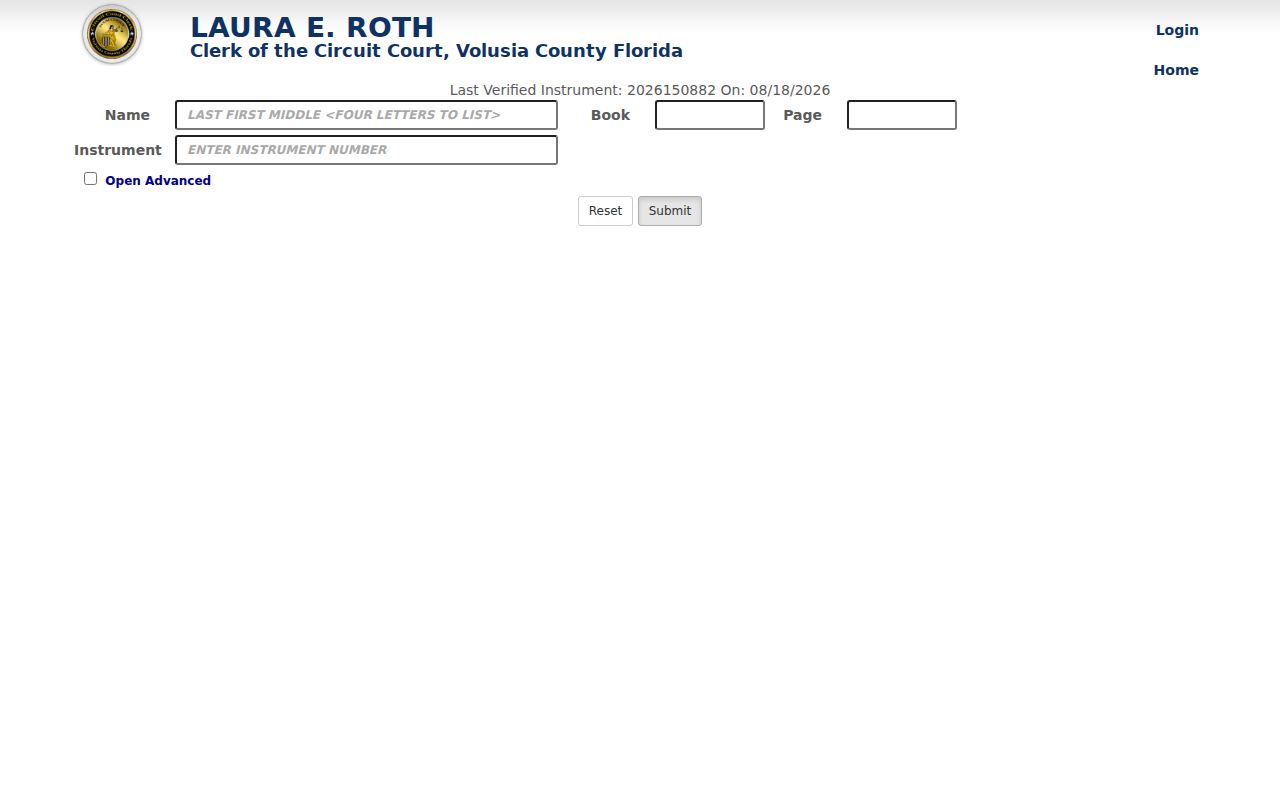
The form's name, instrument, date, document, and parcel filters let the street search continue as a recorded ownership trail.
Deltona Deeds Beyond the Web
The exact online line matters: released Volusia official-record indexes and images begin April 4, 1988. Older records are not automatically missing. The Recording Department's public-research area in Volusia County Courthouse Room A121, DeLand, supplies terminals, microfilm, and digital media reaching 1887. Appointments are recommended for original Historical Records room books, and the office can be reached at 386-736-5912.
Carry the last known book/page, legal description, parcel, and party spellings to the counter. Staff can explain equipment but cannot conduct a title or lien search. Standard copies are generally $1 per page, certification is $2 per instrument, and a record search is $2 per name per year. Newly recorded items may also take time to be recorded, indexed, verified, and released online.
A long county trail. The research-room run begins in 1887, while Deltona's planned development began much later and the city incorporated in 1995. County land keys bridge those eras.
Deltona Voter Data by Street
The statewide voter-status page is an authenticated self-lookup. It requires an exact first name, last name, birth date, agreement, and CAPTCHA. It is not a street browser and should not be tested with someone else's birth date.
For lawful street research, Volusia Elections offers a public-record request channel. Its August 2025 order form permits active, all eligible, or all-four-general-election selections; municipality, precinct, and district geography; and residence-address, residence-address-by-precinct, ZIP, or one-record-per-household sorting. Records can include name, residence address, date of birth, party, status context, and participation history. Ballot choices are never shown. Social Security and driver-license numbers are excluded, signatures are exempt from copying, and protected addresses must be suppressed.
Requests may use NextRequest, email at Elections@Volusia.org, phone at 386-736-5930, mail, or an in-person visit to 1588 N Woodland Boulevard in DeLand. Ask for the current format and price; payment is due when the file is released.
Keep Deltona Street Land Keys
A displayed street name can change in spelling or postal treatment, while the legal description remains the stronger continuity key. Deltona's subdivision-based geography makes the subdivision, lot, block, alternate key, and parcel number especially useful. These fields connect a current parcel card to plats and older deeds even when a historical address does not search cleanly.
The official City election street listing adds another address framework. It includes street, house-number range, precinct split, register city, mail city, ward, ZIP, voter count, and political districts. Use those rows to confirm which range and precinct apply. They show counts, not voter names. Some incorporated-city addresses can also carry an Osteen mail-city label, so a postal name alone does not settle municipal jurisdiction.
When street text fails, search the Clerk by party and book/page, then compare the legal description in the image. For map questions, use VCPA parcel boundaries. For address assignment or annexation questions, ask City or County GIS or planning rather than inferring a boundary from a ZIP or neighborhood name.
Deltona Permits and Old Directories
Building permits and code cases can add construction dates, status, applicants, contractors, or an owner named at the time of filing. Search or request them with the normalized address, parcel number, date range, and department. The precise live field set and coverage were not verified, so a blank portal result is not proof that no file exists.
The Deltona public-record instructions allow oral, written, anonymous, or tracking-portal requests without stating a purpose. The City Clerk supplies existing records and may assess an actual-labor special-service charge for extensive work. City Hall is at 2345 Providence Boulevard, open weekdays from 8 a.m. to 4 p.m.; the main number is 386-878-8100.
Past occupants belong in historical reverse directories, not in the deed chain. Volusia County Public Library provides branch-only Ancestry Library Edition and eligible remote access to HeritageQuest, plus newspaper and obituary databases. Exact Deltona directory years were not verified. The Deltona city directory collections explains how to check broader Volusia, DeLand, Orange City, and Sanford titles without claiming a run that has not been cataloged.
The VCPA contact page shown below lists the property and GIS offices that can resolve a parcel question.
Those contacts are a practical fallback when the address spelling or parcel map does not settle the match.
Limits of Deltona Street Records
A Deltona street directory assembled from official sources remains a set of clues with different legal meanings. The parcel roll is built for assessment, not title certification. Deeds track recorded interests, not every person who stayed at a home. A voter file shows adult registrations subject to exemptions and maintenance rules, not all occupants. Permits can name a contractor or applicant who never lived at the site.
Renters, children, family members, guests, utility accounts, and driver addresses do not appear as one open household list. A missing voter registration can reflect a spelling mismatch, recent update, inactive status, another county, an exemption, or no registration. Likewise, a missing directory entry can mean no volume, no response, an unlisted number, a move, or death.
Lawful use. Use Deltona address records only for lawful personal research, such as family history, deed review, or civic curiosity. Never use them to stalk, harass, intimidate, or harm anyone.
Confirm a key finding with the office that keeps it. If the goal shifts from a whole street to one named person, use the resident lookup workflow and compare two independent identifiers.